

Top 10 Navigation Tools for 2025: Essential Instruments for Every Traveler
Navigating unfamiliar terrain, whether on land or water, has become significantly easier with the development of advanced navigation tools. In 2025, a wide variety of options are available for travelers, sailors, and adventurers alike. From high-tech GPS devices to traditional compasses, the right navigation tool can make all the difference in ensuring a safe and successful journey. This article will walk you through the top 10 navigation tools that every explorer should have in their arsenal.

1. GPS Devices: The Ultimate Modern Navigation Tool
In today’s world, GPS devices are one of the most common and reliable navigation tools available. These devices use satellite signals to provide real-time positioning, helping users find their way with remarkable accuracy.
Key Features:
-
Real-time location tracking with precise mapping.
-
Offline capabilities, allowing navigation without internet access.
-
Route planning for specific destinations, even in remote areas.
Whether you’re a road trip enthusiast or a sailor, a GPS device is indispensable for navigation in today’s world.
Recommended Device:
Garmin GPSMAP Series offers excellent reliability for both land and sea navigation. Learn more about Garmin GPS devices here.
2. Smartphone Navigation Apps: Portable & Versatile
If you own a smartphone, you already have a powerful navigation tool at your fingertips. Navigation apps such as Google Maps, Apple Maps, and Waze provide easy-to-use solutions for on-the-go travel.
Key Features:
-
Real-time traffic updates and route suggestions.
-
Turn-by-turn directions for driving, walking, and cycling.
-
Offline maps in case of poor signal areas.
For daily commuters, casual travelers, or urban explorers, smartphone apps are perfect for easy navigation.

3. Marine GPS Systems: Navigation for Sea Travelers
For sailors and those navigating the waterways, a marine GPS system is essential. These systems are designed specifically for maritime navigation, with waterproof designs and enhanced functions for sea conditions.
Key Features:
-
Mapping for marine environments including coastlines, harbors, and submerged hazards.
-
Integration with radar and sonar for enhanced navigation.
-
Weather forecasting and tidal information to avoid dangerous waters.
Garmin’s Marine GPS Series is a top choice for those in the maritime industry. Learn more about marine navigation here.
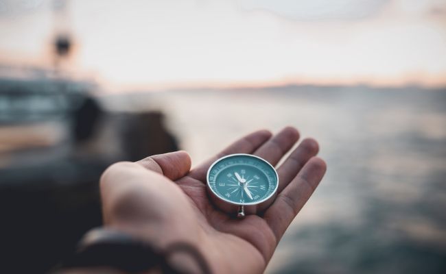
4. Traditional Compasses: The Timeless Navigator
While modern tools have their advantages, the traditional compass remains a reliable navigation tool for those seeking a more tactile approach to direction. It is especially useful in outdoor adventures like hiking or backcountry travel.
Key Features:
-
Durable and lightweight for ease of use.
-
No batteries required, making it perfect for emergencies.
-
Simple yet reliable in finding true north.
A compass may seem old-fashioned, but it has been a trustworthy tool for centuries, especially in remote areas without access to electronics.
5. Digital Marine Charts: Navigating with Precision
For sailors, digital marine charts provide an interactive, digital version of traditional nautical maps. These charts allow for more detailed analysis of water routes, depths, and maritime features.
Key Features:
-
Detailed mapping of marine environments, including currents, tides, and hazards.
-
Integration with other navigation tools such as GPS systems.
-
Up-to-date data on water conditions and navigation routes.
Navionics is a popular brand for high-quality digital marine charts. Learn how digital charts enhance maritime navigation here.
6. Echosounders: Understanding the Depths
An echosounder is an essential tool for sailors and fishermen, helping to measure the depth of water below your vessel. This device is particularly useful for avoiding shallow areas and locating underwater objects or obstacles.
Key Features:
-
Accurate depth measurements for safe navigation.
-
Sonar technology to detect underwater structures and obstacles.
-
Integration with GPS systems for precise location mapping.
With an echosounder, sailors and boaters can ensure they avoid potential hazards lurking beneath the surface of the water.
7. Radar Systems: Enhancing Visibility on the Water
In conditions of poor visibility such as fog or heavy rain, radar systems become invaluable for maritime navigation. These systems use radio waves to detect objects and landmasses, improving safety and route planning.
Key Features:
-
Detection of obstacles even in low-visibility conditions.
-
Distance measurement to estimate the location of nearby objects.
-
Weather data integration for safer passage.
Radar systems are vital for maintaining safety on the open sea, particularly in challenging weather conditions.
8. Electronic Chart Display and Information Systems (ECDIS)
An ECDIS combines GPS with detailed electronic charts to create a comprehensive navigation tool for professional mariners. These systems allow for real-time updates and adjustments to your route, ensuring the safest journey possible.
Key Features:
-
Real-time chart updates for changing conditions.
-
Automatic route plotting and correction.
-
Safety warnings for nearby hazards such as shallow waters or storms.
ECDIS is mandatory on many commercial ships and a great tool for those navigating large-scale waterways. More about ECDIS systems here.
9. Handheld GPS Units: Portable Navigation Tools
When space is limited or you’re on the move, handheld GPS units are a perfect solution. These compact devices are ideal for hiking, backpacking, or even geocaching adventures.
Key Features:
-
Compact and lightweight, perfect for carrying on foot.
-
Long battery life for extended trips in the wilderness.
-
Pre-loaded topographic maps for hiking and exploring.
Brands like Garmin and Magellan offer reliable handheld units that work in remote areas with little to no signal.
10. Augmented Reality Navigation: The Future of Navigation
Augmented Reality (AR) navigation tools are an exciting new frontier in the world of navigation. These systems overlay digital maps and information onto the physical world, enhancing your ability to navigate.
Key Features:
-
Live navigation directions displayed in your field of view.
-
Interactive maps that appear on your smartphone or AR glasses.
-
Enhanced situational awareness in urban and outdoor environments.
While still evolving, AR navigation has the potential to revolutionize how we interact with our surroundings and find our way.
FAQs About Navigation Tools
What is the best GPS device for hiking?
For hiking, Garmin’s GPSMAP series offers excellent features for outdoor navigation, including topographic maps and long battery life. It’s designed to handle tough terrain and provide reliable GPS data.
Can I use my smartphone as a navigation tool?
Yes, smartphones are fantastic navigation tools with apps like Google Maps and Apple Maps, which provide real-time traffic updates, turn-by-turn directions, and offline maps.
What is the most accurate navigation tool for marine travel?
For marine travel, Marine GPS systems such as Garmin’s GPSMAP Series or Navionics digital charts offer the most precise navigation tools, with additional features like weather updates and hazard alerts.
Is an echosounder necessary for recreational boating?
An echosounder is highly recommended for recreational boating, especially if you’re navigating in shallow waters or fishing. It helps you avoid obstacles and ensures safe travel.
Conclusion
Choosing the right navigation tool depends on your specific needs and the environment you’re navigating. Whether you rely on traditional compasses or the latest GPS devices, these top 10 tools offer comprehensive solutions for explorers, sailors, hikers, and travelers. By understanding the features and benefits of each tool, you can select the perfect one to ensure a safe and efficient journey.
Explore more about navigation technologies and start your next adventure with confidence! Learn more here.
